
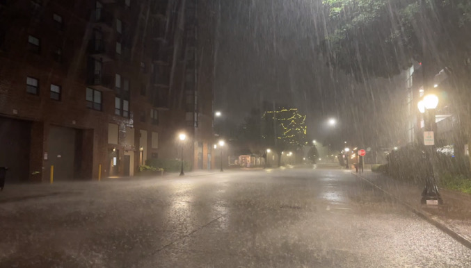
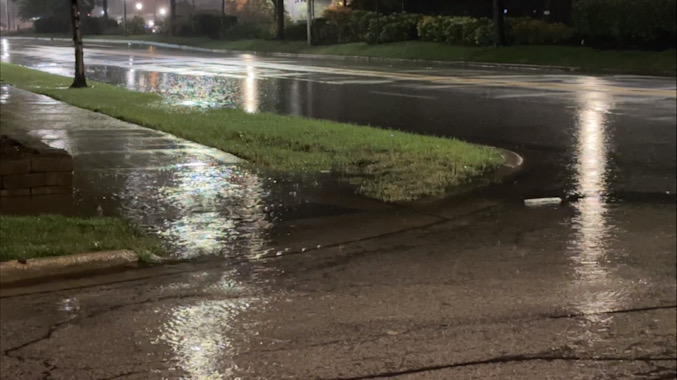
A line of thunderstorms passed through the Arlington Heights area by 4:30 a.m. with no significant winds and only brief heavy rain in downtown Arlington Heights and surrounding areas.
No fire calls were dispatched related to storm damage as of 5:00 a.m. Tuesday, August 6, 2024.
According to the National Weather Service Chicago, a cold front will crash through the area today leading to cooler temperatures, low clouds, and sprinkles from time to time.
Dangerous swimming conditions will develop at all southern Lake Michigan beaches this morning and last through the first half of Wednesday.
Dry and cooler weather is expected to continue through the middle to the end of the week.
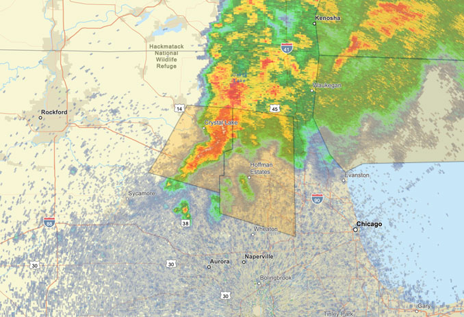
Weather Radarat 3:40 AM showed precipitation growing and intensifying and moving east-southeast in a line from Racine, Wisconsin to the west side of Elgin.
See also Arlingtoncardinal.com/clouds
A line of thunderstorms crossing southern Wisconsin is expected to brush northern Illinois, primarily north of I-88, overnight through sunrise Tuesday. Gusty winds and small hail can be expected with these storms, with the potential for locally damaging winds. pic.twitter.com/OpytPQE6ee
— NWS Chicago (@NWSChicago) August 6, 2024
O’HARE FORECAST …
Overnight: A 50 percent chance of showers and thunderstorms. Mostly cloudy, with a steady temperature around 74. South wind 5 to 10 mph.
Tuesday: A chance of showers and thunderstorms. Cloudy, with a temperature falling to around 67 by 11am. Breezy, with a northwest wind 10 to 20 mph becoming north northeast in the morning. Winds could gust as high as 30 mph. Chance of precipitation is 50%.
Tuesday Night: A chance of sprinkles before 1am. Cloudy during the early evening, then gradual clearing, with a low around 63. Northeast wind 10 to 15 mph, with gusts as high as 25 mph.
Wednesday: Sunny, with a high near 76. East northeast wind 10 to 15 mph, with gusts as high as 20 mph.
Wednesday Night: Partly cloudy, with a low around 64. Northeast wind 5 to 10 mph becoming light east after midnight. Winds could gust as high as 15 mph.
Thursday: Mostly sunny, with a high near 82.
Thursday Night: Partly cloudy, with a low around 65.
Friday: Mostly sunny, with a high near 79.
Friday Night: Mostly clear, with a low around 60.
Saturday: Mostly sunny, with a high near 76.
Saturday Night: Mostly clear, with a low around 60.
Sunday: Sunny, with a high near 80.
Sunday Night: Partly cloudy, with a low around 62.
Monday: Mostly sunny, with a high near 82.
LAKE TEMPS …
SOUTHERN LAKE MICHIGAN WATER TEMPERATURES
NATIONAL WEATHER SERVICE CHICAGO/ROMEOVILLE IL
916 AM CDT Mon Aug 5 2024
LAKE MICHIGAN WATER TEMPERATURES…
CHICAGO SHORE………..76.
CHICAGO CRIB…………71.
CHICAGO BUOY…………77.
WILMETTE BUOY………..77.
WAUKEGAN BUOY………..78.
WINTHROP HARBOR BUOY….77.
MICHIGAN CITY………..63.
MICHIGAN CITY BUOY……74.
SOUTH MID LAKE BUOY…..76.
CENTRAL MID LAKE BUOY…74.
NORTH MID LAKE BUOY…..72.
&&
M IS FOR MISSING DATA THAT IS NORMALLY AVAILABLE.
THE MICHIGAN CITY WATER TEMPERATURE SENSOR IS LOCATED AT
A WATER INTAKE ONE MILE OFFSHORE AND 60 FEET BELOW THE
WATER SURFACE. IT IS READ EVERY DAY OF THE YEAR.
august.chicagoweatherstation.com
Chicago Weather Forecast for your MAC/PC/TABLET includes surrounding suburbs.
^^ MOBILE? USE VOICE MIC ^^
facebook …
Please ‘LIKE’ the ‘Arlington Cardinal Page. See all of The Cardinal Facebook fan pages at Arlingtoncardinal.com/about/facebook …
Help fund The Cardinal Arlingtoncardinal.com/sponsor
Area Forecast Discussion National Weather Service Chicago/Romeoville, IL 215 AM CDT Tue Aug 6 2024
.KEY MESSAGES…
– A cold front will crash through the area today leading to cooler temperatures, low clouds, and sprinkles from time to time.
– Dangerous swimming conditions will develop at all southern Lake Michigan beaches this morning and last through the first half of Wednesday.
– Dry and cooler weather is expected to continue through the middle to the end of the week.
&&
.DISCUSSION… Issued at 215 AM CDT Tue Aug 6 2024
Through Wednesday:
A recent hand surface analysis revealed a 1010mb surface low pressure system centered near Cedar Rapids, Iowa, cold front stretching southwestward through central Iowa into the central Plains, and a warm front laid from the Wisconsin state line into southern Lower Michigan. The surface instability axis is somewhat displaced southwest of the synoptic warm front (thanks to thunderstorms yesterday evening across northern Illinois), and currently arcs from near Davenport, IA to Bloomington, IL. Showers and thunderstorms continue along and north of the warm front in southern Wisconsin, and have thus far had very limited penetration into far northern Illinois.
Over the next 12 to 28 hours or so, the surface low is expected to move east-southeastward along a path roughly from Davenport, IA to Cincinnati, OH. As it does so, the warm front draped along the Wisconsin state line will collapse southward through the Great Lakes. Increasingly breezy north to northeast winds (gusting as high as 30 mph) will usher in low-level stratus and cooler temperatures. Meanwhile, an initially warm and sunny start to the day near US-24 will turn cooler by early afternoon as temperatures fall and low- level stratus arrives. Stratus will linger through the afternoon areawide, and potentially thicken near Lake Michigan leading to areas of sprinkles. In all, today will turn decidedly “fall” like.
Low-level stratus is expected to erode from north to south this evening and overnight as a surface high builds into the Upper Great Lakes. Tomorrow should accordingly feature quite a bit of sunshine, allowing highs to rebound into the upper 70s to lower 80s. Continued breeze northeast winds will hold lakeshore locations in the lower 70s.
Finally with sustained northeasterly winds down a long fetch of Lake Michigan today and tonight, dangerous swimming conditions will develop and stay from this morning onward. The low-level pressure gradient will be slow to ease, so dangerous waves will likely continue through at least the first half of Wednesday.
Borchardt
Wednesday Night through Monday:
Dry and cooler weather is expected through the extended forecast. A deep shortwave and surface low pressure system is expected to advance across the northern Great Lakes on Thursday with an associated cold front passing overhead late Thursday night. Despite the lift provided by the cold front, no precipitation expected due to very dry mid-level air. Highs will be in the mid-to-upper 70s Friday and Saturday behind the cold front with strong northerly/northwesterly flow. These strong northerly winds could pose a threat to beachgoers this weekend, particularly in NW IN, with large waves building.
Carothers
&&
.AVIATION /06Z TAFS THROUGH 12Z WEDNESDAY/… Issued at 1235 AM CDT Tue Aug 6 2024
Key Aviation Messages:
– An area of convection is expected to move through the northern portion of the area early this morning.
– MVFR to IFR CIGs will prevail through the day Tuesday.
– Strong northeasterly winds tomorrow with 25-30 kt gusts.
Discussion:
An area of ongoing convection in SW WI is expected to continue advancing towards the area over the next couple of hours. Uncertainty remains in the exact progression of this system although current thinking is that it will be confined to far northern IL. Because of this uncertainty, have not included TS in the Chicago area TAFs. With KRFD being further north and west, the likelihood of storms impacting the terminal are higher, so have opted for a TEMPO with -TSRA there. KGYY looks to be too far south for storms to impact the terminal, however, some shower activity may come close.
The bigger impact at KGYY is the potential for reduced visibility from fog overnight. Several areas of reduced visibility are already present in the more rural areas of NW IN and northern IL due to a high low-level moisture content. This fog seems poised to spread towards, if not to, the KGYY terminal. Have opted to cover this with a TEMPO for reduced visibility through sunrise.
Behind the ongoing convection, MVFR to IFR CIGs are being observed across southern MN. Expectation is that these CIGs will move into the area tomorrow morning and persist through the day. Currently have low-end MVFR CIGs in the TAFs, however, it is not out of the realm of possibility that IFR CIGs prevail for the majority of the day. CIGs should slowly start to lift and scatter out late in the TAF period, however, MVFR CIGs will likely hang around until early Wednesday morning.
Winds are expected to be primarily out of the SE ahead of the convection this morning, however, they will likely swing around to SW for an hour or two just before the convection reaches the terminals. Behind the convection, they will turn NE and remain there through the end of the TAF period. Tomorrow will likely see some gusty winds (25 to 30 kt gusts), however, they will drop off after sunset.
Carothers
&&
.LOT WATCHES/WARNINGS/ADVISORIES… IL…Beach Hazards Statement through Wednesday afternoon for ILZ006.
Beach Hazards Statement from 10 AM CDT this morning through Wednesday afternoon for ILZ103-ILZ104.
IN…Beach Hazards Statement from 1 PM CDT this afternoon through Wednesday afternoon for INZ001-INZ002.
LM…Small Craft Advisory until 3 PM CDT Wednesday for Winthrop Harbor to Wilmette Harbor IL.
Small Craft Advisory from 10 AM this morning to 3 PM CDT Wednesday for Wilmette Harbor to Calumet Harbor IL.
Small Craft Advisory from 1 PM this afternoon to 3 PM CDT Wednesday for the IN nearshore waters.