

The Chicagoland forecast includes a Storm Prediction Center’s Day 1 Enhanced (level 3 of 5 severity), and Weather Prediction Center slight (level 2 of 5 severity) risks of severe and excessive rainfall.
Mostly sunny skies are expected Monday morning, allowing temperatures to warm into the low-mid 90s area-wide through Monday afternoon. The potential exists for increasing high clouds to increase by this afternoon from decaying upstream convection, leading to somewhat lower confidence in widespread high temperatures in the mid-90s. However, combined with surface dew points in the mid- to upper- 70s especially across Illinois rural farmland, peak afternoon heat indices between 105-110F are likely at least part of the day Monday.
A Heat Advisory activated for Illinois counties exists roughly south of a line from Forreston to Joliet to Beecher line from noon through 7 pm CDT, where values of 105F and above are most likely. If cloud cover Monday afternoon is thinner or with less coverage, temperatures could be higher than expected, and the Heat Advisory could be expanded further north and east into the Chicago metro area.
Another round of strong to severe thunderstorms is forecast for late Monday afternoon into Monday night. Thunderstorm development depends upon how thunderstorm clusters currently ongoing across the eastern Dakotas evolve through the remainder of the morning hours.
An area of surface low pressure is expected to deepen across the upper Midwest and northern Great Lakes region through this evening, in response to a mid-level short wave transiting the south/southeast periphery of an upper low over eastern Manitoba/western Ontario (a large dome of cool air is forecast to arrive from Canada later this week). A weak cold front trailing this low is forecast to slowly move southeast across the upper Mississippi Valley, eventually reaching northern Illinois later tonight.
Local thunderstorm development is expected by mid-late afternoon in northwest Illinois ahead of the cold front, and within a very warm/humid high “heated” airmass characterized by dew points in the low-mid 70s across Iowa, Wisconsin and northern Illinois.
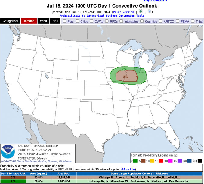
Higher-end severe winds appear to be the greatest threat in these storms; however, there is indication of sufficient low-level shear which would conditionally support a tornado threat in the front line storms.
The severe threat looks to be mainly focused within the evening hours, perhaps a bit longer in far east/southeast near northwest Indiana (similar to Sunday night).
A locally heavy rainfall/flash flood threat will exist as well, especially along the trailing portion of the linear Mesoscale Convective System (MCS) that may become more organized than initial individual thunderstorms, and may tend to become more west-east oriented after midnight.
Weather Radar in northeast Illinois was clear in advanced of severe storms that are expected to begin abruptly around 7:00 p.m. to 8:00 p.m. near Arlington Heights and northwest Cook County.
See also Arlingtoncardinal.com/clouds
Another round of strong to severe thunderstorms is anticipated to move across the area this evening and into tonight. Strong, destructive winds are the primary concern, although tornadoes, large hail, and flash flooding will all be possible. pic.twitter.com/iw2vI42qXw
— NWS Chicago (@NWSChicago) July 15, 2024
More strong to severe thunderstorms are expected this evening and tonight with additional storms possible tomorrow, mainly south of I-80. After another toasty one today, conditions become much more comfortable closer to midweek. pic.twitter.com/IK8MjIAldd
— NWS Chicago (@NWSChicago) July 15, 2024
Dangerous heat and humidity will build across the region today, with afternoon heat indices in the 100-110° range. A heat advisory has been issued for portions of northern and central Illinois where conditions are expected to be the hottest. pic.twitter.com/bbCaab3I9w
— NWS Chicago (@NWSChicago) July 15, 2024
O’HARE FORECAST …
Monday: Mostly sunny, with a high near 92. Heat index values as high as 101. Southwest wind 5 to 10 mph, with gusts as high as 25 mph.
Monday Night: Showers and thunderstorms likely, mainly before 1am. Some of the storms could be severe and produce heavy rainfall. Mostly cloudy, with a low around 73. Southwest wind around 10 mph, with gusts as high as 25 mph. Chance of precipitation is 70%. New rainfall amounts between three quarters and one inch possible.
Tuesday: A slight chance of showers and thunderstorms between 7am and 1pm. Partly sunny, with a high near 84. West northwest wind 5 to 10 mph. Chance of precipitation is 20%.
Tuesday Night: Partly cloudy, with a low around 66. North wind around 5 mph.
Wednesday: Mostly sunny, with a high near 80. North wind 5 to 10 mph, with gusts as high as 15 mph.
Wednesday Night: Mostly clear, with a low around 62.
Thursday: Sunny, with a high near 76.
Thursday Night: Clear, with a low around 58.
Friday: Sunny, with a high near 80.
Friday Night: Mostly clear, with a low around 62.
Saturday: Mostly sunny, with a high near 83.
Saturday Night: Partly cloudy, with a low around 65.
Sunday: Partly sunny, with a high near 83.
LAKE TEMPS …
SOUTHERN LAKE MICHIGAN WATER TEMPERATURES
NATIONAL WEATHER SERVICE CHICAGO/ROMEOVILLE IL
920 AM CDT Mon Jul 15 2024
LAKE MICHIGAN WATER TEMPERATURES…
CHICAGO SHORE………..71.
CHICAGO CRIB…………64.
CHICAGO BUOY…………71.
WILMETTE BUOY………..72.
WAUKEGAN BUOY………..70.
WINTHROP HARBOR BUOY….71.
MICHIGAN CITY BUOY……72.
SOUTH MID LAKE BUOY…..69.
CENTRAL MID LAKE BUOY…69.
NORTH MID LAKE BUOY…..68.
&&
july.chicagoweatherstation.com
Chicago Weather Forecast for your MAC/PC/TABLET includes surrounding suburbs.
^^ MOBILE? USE VOICE MIC ^^
facebook …
Please ‘LIKE’ the ‘Arlington Cardinal Page. See all of The Cardinal Facebook fan pages at Arlingtoncardinal.com/about/facebook …
Help fund The Cardinal Arlingtoncardinal.com/sponsor
 Amazon Best Sellers in Audible Books