

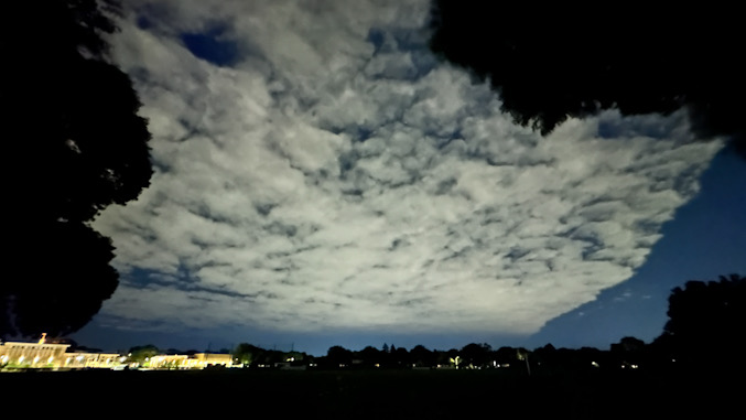
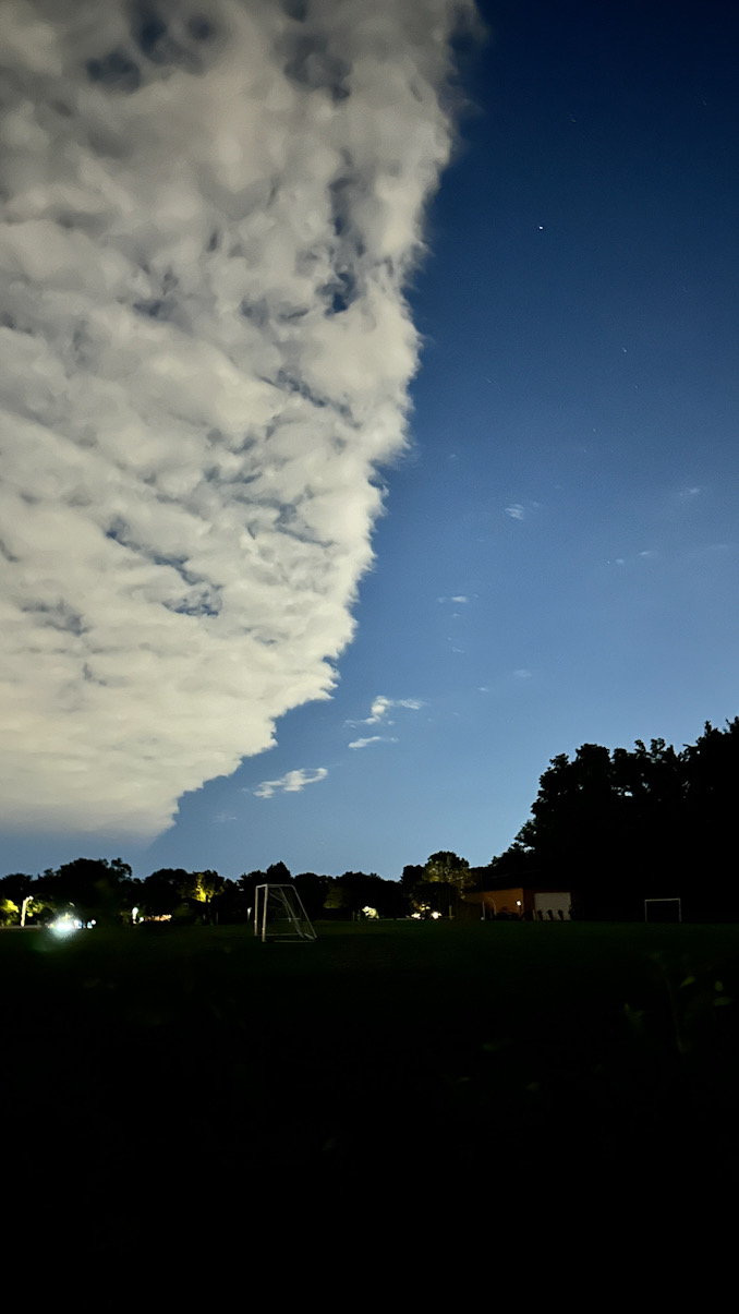
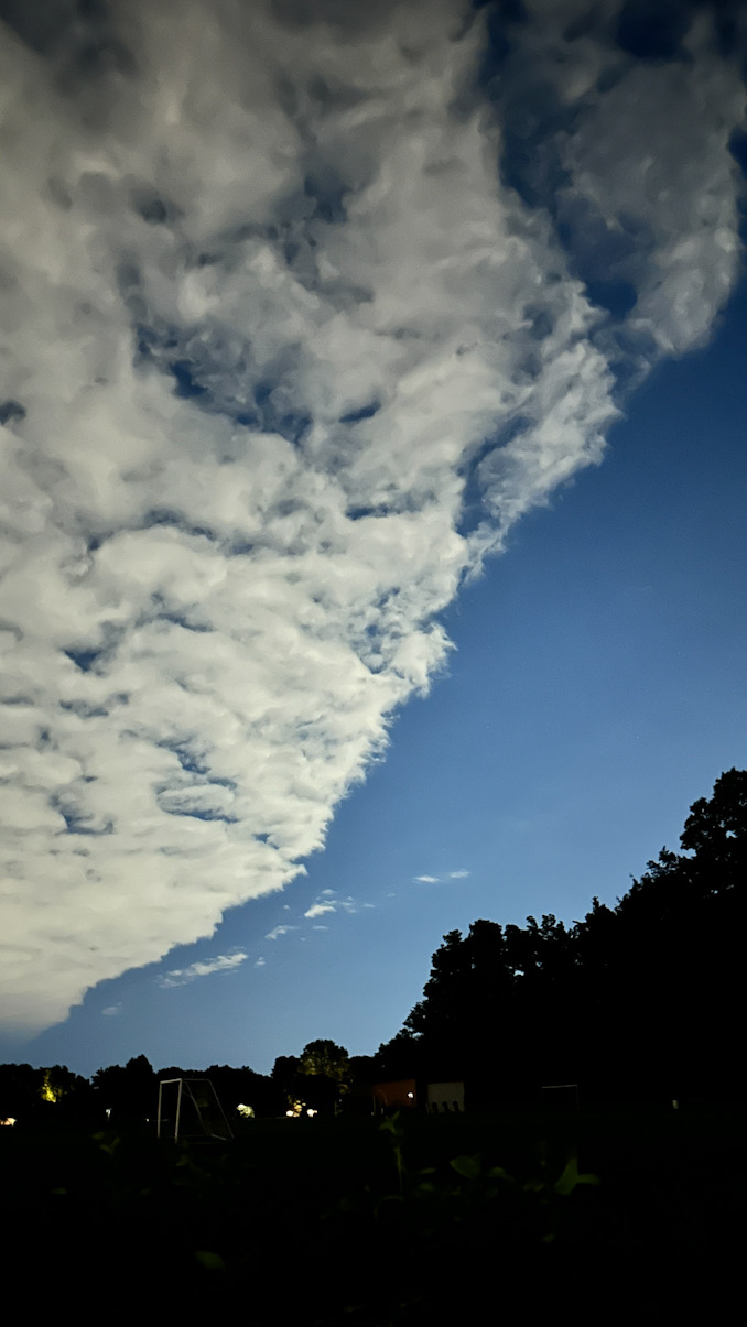
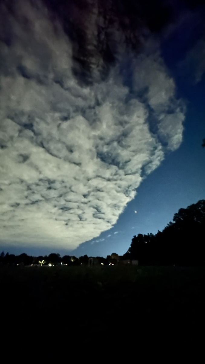
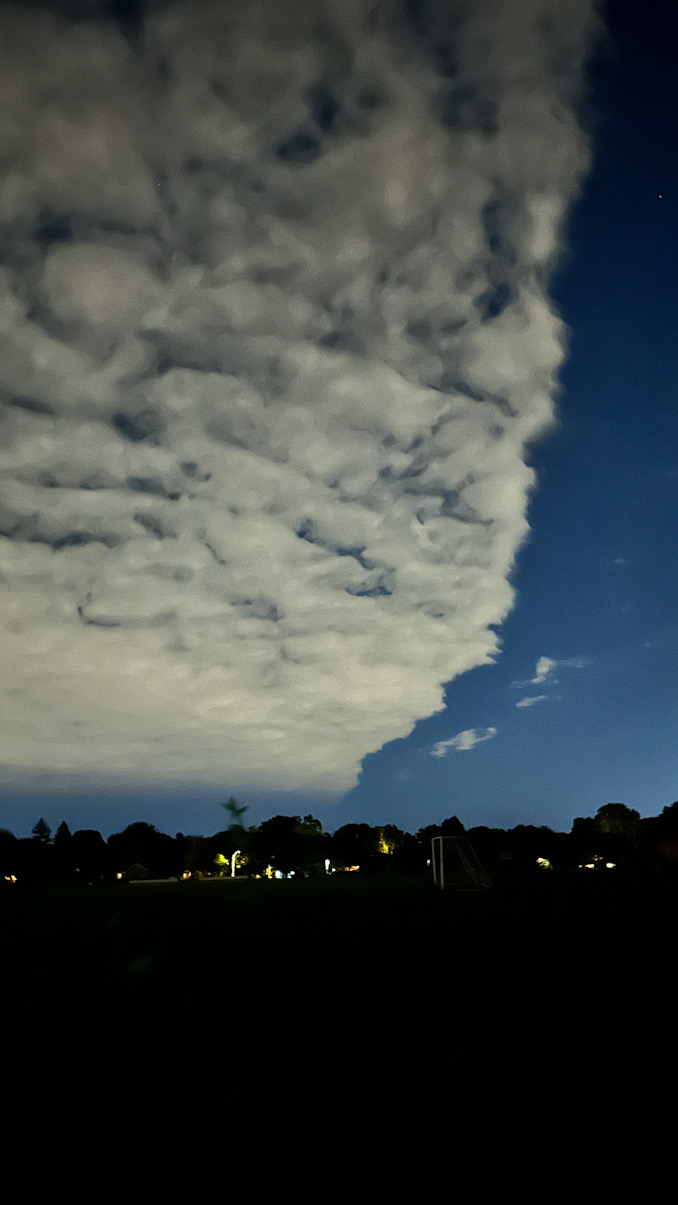
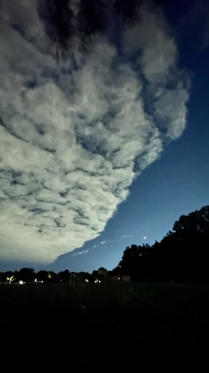
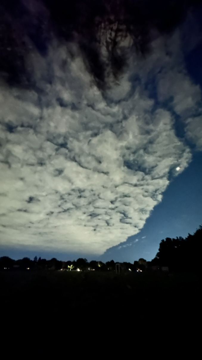
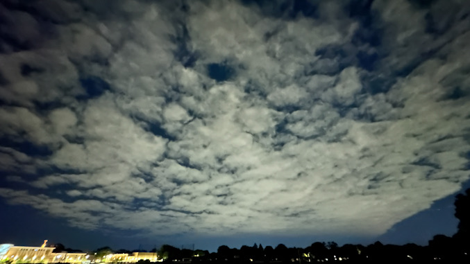
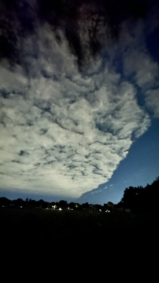
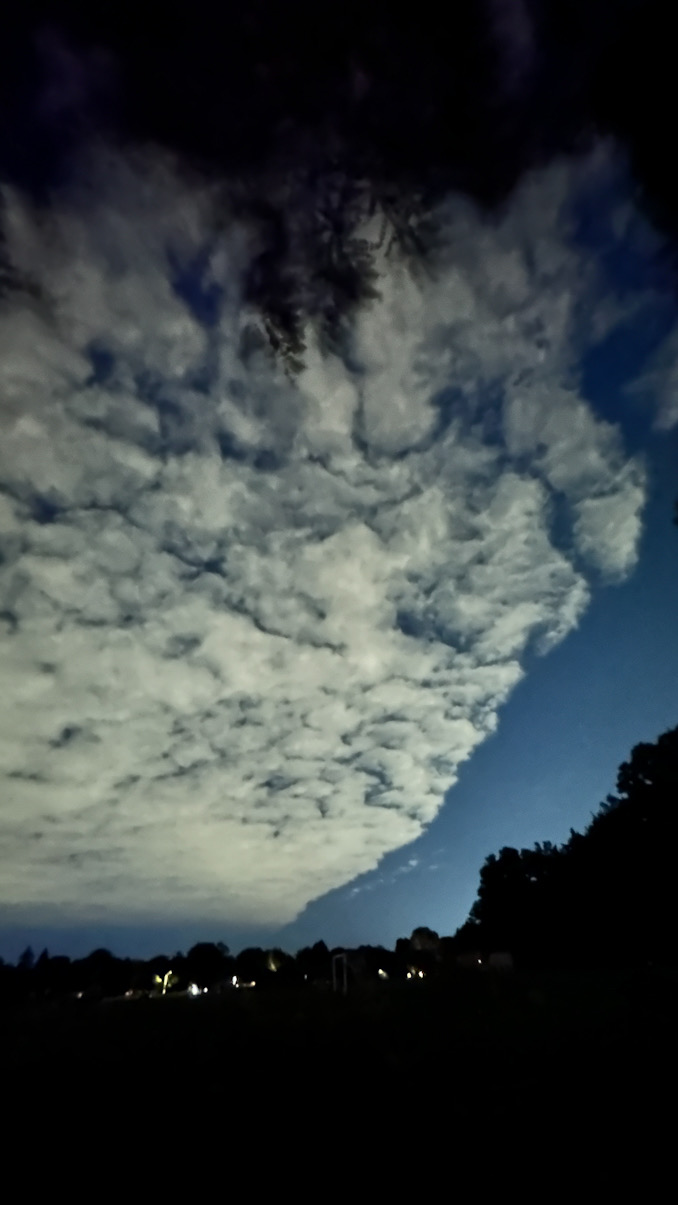
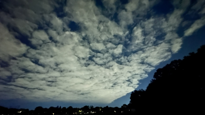
Eroding clouds, stratus and shallow cumulus hitting dry advection in northern Illinois about 10:00 p.m. Sunday, June 9, 2024 (CARDINAL NEWS). YouTube Tips ⓘ
Dangerous swimming conditions are forecast Sunday overnight through the day Monday, June 10, 2024.
A mid-level trough and associated surface trough/front will shift south-southeast across the Chicagoland forecast area Sunday evening into the early overnight hours. The weather conditions caused a spectacular sky show over St Viator High School Sunday night, June 9, 2024.
Weather conditions overnight may allow post-frontal stratus clouds to grow sufficiently deep to squeeze out some sprinkles or patches of drizzle, especially near Lake Michigan where added lake moisture from a long fetch will counteract overall synoptic dry air advection.
Diurnal heating (Day/Night heating and cooling) and continued dry advection should erode the stratus clouds or lift and scatter the stratus into shallow cumulus from north to south through the morning Monday.
Apparently that “battle” of cloud growth vs. cloud erosion was happening over St Viator around 10:00 p.m. Sunday.
Weather Radar in northeast Illinois was clear 10:00 p.m.
Clouds were observed on satellite view forming of southern Wisconsin and then dissipating while hitting an abrupt dry area over northern Illinois near the Lake County, Cook County border, and over the Lake Michigan shoreline.
See also Arlingtoncardinal.com/clouds
Breezy northerly winds will persist into Monday generating seasonably cool temperatures to start the week. Temperatures will turn more summer-like through the later half of the week followed by chances for showers and thunderstorms Wednesday night and Thursday. #ILwx #INwx pic.twitter.com/LzYS7OSJOu
— NWS Chicago (@NWSChicago) June 9, 2024
O’HARE FORECAST …
Beach Hazards Statement (below)
Hazardous Weather Outlook (below)
Sunday Night: A slight chance of showers between midnight and 4am. Mostly cloudy, with a low around 54. North wind 10 to 15 mph. Chance of precipitation is 20%.
Monday: Sunny, with a high near 67. North northeast wind 10 to 15 mph, with gusts as high as 20 mph.
Monday Night: Clear, with a low around 50. North northeast wind 5 to 10 mph becoming light north northwest after midnight.
Tuesday: Mostly sunny, with a high near 77. Calm wind becoming southwest around 5 mph in the afternoon.
Tuesday Night: A 20 percent chance of showers. Partly cloudy, with a low around 64. South wind 5 to 10 mph.
Wednesday: Mostly sunny, with a high near 86.
Wednesday Night: Partly cloudy, with a low around 68.
Thursday: A chance of showers and thunderstorms after 1pm. Mostly sunny, with a high near 86.
Thursday Night: A chance of showers and thunderstorms. Partly cloudy, with a low around 66.
Friday: Sunny, with a high near 84.
Friday Night: Mostly clear, with a low around 62.
Saturday: Mostly sunny, with a high near 80.
Saturday Night: Partly cloudy, with a low around 66.
Sunday: Sunny, with a high near 89.
Coastal Hazard Message
National Weather Service Chicago IL
921 PM CDT Sun Jun 9 2024
Lake IL-Northern Cook-Central Cook-Lake IN-Porter- 921 PM CDT Sun Jun 9 2024
…BEACH HAZARDS STATEMENT REMAINS IN EFFECT THROUGH LATE MONDAY NIGHT…
* WHAT…High wave action and dangerous currents expected at Lake Michigan beaches. Waves 5 to 8 ft expected.
* WHERE…In Illinois, Lake IL, Northern Cook and Central Cook Counties. In Indiana, Lake IN and Porter Counties.
* WHEN…Through late Monday night.
* IMPACTS…Swimming conditions will be life threatening, especially for inexperienced swimmers. For information on swim advisories or bans at Chicago beaches: www. cpdbeaches. com.
PRECAUTIONARY/PREPAREDNESS ACTIONS…
Remain out of the water to avoid dangerous swimming conditions and do not venture out onto piers, jetties, breakwalls, or other shoreline structures.
Hazardous Weather Outlook
National Weather Service
Chicago/Romeoville IL
955 PM CDT Sun Jun 9 2024
Winnebago-Boone-McHenry-Lake IL-Ogle-Lee-De Kalb-Kane-DuPage- La Salle-Kendall-Grundy-Kankakee-Livingston-Iroquois-Ford- Northern Cook-Central Cook-Southern Cook-Northern Will- Southern Will-Eastern Will-Lake IN-Porter-Newton-Jasper-Benton- 955 PM CDT Sun Jun 9 2024 /1055 PM EDT Sun Jun 9 2024/
This Hazardous Weather Outlook is for portions of north central Illinois…northeast Illinois and northwest Indiana.
.DAY ONE…Tonight.
Weather hazards expected…
High Swim Risk Lake Michigan Beaches.
DISCUSSION…
Strengthening onshore winds this evening will result in dangerous swimming conditions at southern Lake Michigan beaches.
.DAYS TWO THROUGH SEVEN…Monday through Saturday.
Monday… High Swim Risk Lake Michigan Beaches.
Wednesday night through Friday… Limited Thunderstorm Risk.
LAKE TEMPS …
SOUTHERN LAKE MICHIGAN WATER TEMPERATURES
NATIONAL WEATHER SERVICE CHICAGO/ROMEOVILLE IL
907 AM CDT Sun Jun 9 2024
LAKE MICHIGAN WATER TEMPERATURES…
CHICAGO SHORE………..62.
CHICAGO CRIB…………60.
CHICAGO BUOY…………60.
WILMETTE BUOY………..59.
WAUKEGAN BUOY………..54.
WINTHROP HARBOR BUOY….55.
MICHIGAN CITY…………M.
MICHIGAN CITY BUOY……62.
SOUTH MID LAKE BUOY…..57.
CENTRAL MID LAKE BUOY…54.
NORTH MID LAKE BUOY…..55.
&&
M IS FOR MISSING DATA THAT IS NORMALLY AVAILABLE.
THE MICHIGAN CITY WATER TEMPERATURE SENSOR IS LOCATED AT A WATER INTAKE ONE MILE OFFSHORE AND 60 FEET BELOW THE WATER SURFACE. IT IS READ EVERY DAY OF THE YEAR.
june.chicagoweatherstation.com
Chicago Weather Forecast for your MAC/PC/TABLET includes surrounding suburbs.
^^ MOBILE? USE VOICE MIC ^^
facebook …
Please ‘LIKE’ the ‘Arlington Cardinal Page. See all of The Cardinal Facebook fan pages at Arlingtoncardinal.com/about/facebook …
Help fund The Cardinal Arlingtoncardinal.com/sponsor
Area Forecast Discussion
National Weather Service
Chicago/Romeoville, IL
627 PM CDT Sun Jun 9 2024
.KEY MESSAGES…
– A cold front will arrive this evening with gusty northerly winds lasting through Monday along with building waves and dangerous swimming conditions for Lake Michigan beaches.
– Tuesday through the end of the week will feature increasing temperatures and chances for showers and thunderstorms, with the latter particularly on Thursday and Friday.
– After a brief respite on Saturday, summer-like temperatures are poised to return early next week.
&&
.DISCUSSION… Issued at 233 PM CDT Sun Jun 9 2024
Through Monday night:
A mid-level trough and associated surface trough/front will shift S/SSE across the forecast area this evening into the early overnight hours. A wind shift from WNW to NE with gusts to 20 knots is expected along the Lake Michigan shore early to mid- evening and will result in deteriorating swimming conditions. A Beach Hazard Statement remains in effect beginning 9pm this evening for the entire Lake Michigan shore in IL and IN, with the potential for dangerous swimming conditions to begin as early as 8pm if the front exhibits a quicker forward motion over the next several hours. A secondary wind push late this evening with gusts of 25 knots or higher will generate continued dangerous swimming conditions through the day Monday.
A mixed nocturnal PBL owing to modest CAA overnight may allow the post frontal stratus to grow sufficiently deep to squeeze out some sprinkles or patches of drizzle. This is particularly the case near the lake where added lake moisture from a long fetch will counteract overall synoptic dry air advection. Have opted to include slight chance sprinkles roughly around the lake-adjacent counties late this evening through sunrise Monday.
Otherwise, diurnal heating and continued dry advection should erode the stratus or lift and scatter the stratus into shallow cumulus from north to south through the morning Monday. Max temps will be well below normal for early/mid June, with highs ranging from the low 60s along the shore to the low 70s well inland. Mostly clear skies and a passing ridge Monday night will yield a chilly night with lows in the mid to upper 40s inland to the low 50s in the core of the Chicago metro.
– Kluber/NWS Chicago
 Amazon Best Sellers in Audible Books