NWS FORECAST: KORD | KPWK | Forecast Graph O’Hare
***********
O’HARE FORECAST …
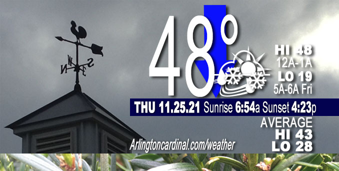
Thanksgiving Day: Scattered rain and snow showers before 4pm, then scattered flurries between 4pm and 5pm. Mostly cloudy, with a temperature falling to around 33 by 5pm. North northwest wind around 15 mph, with gusts as high as 25 mph. Chance of precipitation is 50%.
Tonight: Mostly cloudy, then gradually becoming clear, with a low around 19. Northwest wind 10 to 15 mph, with gusts as high as 25 mph.
Friday: Increasing clouds, with a high near 34. West northwest wind 5 to 10 mph becoming south southwest in the afternoon.
Friday Night: Mostly cloudy, with a low around 28. South wind around 5 mph.
Saturday: A 20 percent chance of showers after noon. Partly sunny, with a high near 42. South wind around 5 mph, with gusts as high as 10 mph.
Conditions remain rather mild across the area early this morning in advance of a quickly approaching cold front, that is now shifting across the Rockford area in north central Illinois. The area of light rain has remained in advance of this front in association with a mid-level disturbance and a band of enhanced 700 mb frontogenesis oriented southwest to northeast right across the southern sections of the Chicago metro. Expect this area of rain to continue to shift off to the east-southeast overnight, ending across my southeastern areas by, or shortly after, daybreak.
While the main area of rain ended across the area early this morning, trends continue to support the development of another area of precipitation later this morning and into the afternoon as the main mid-level trough axis moves overhead. This especially appears to be the case over parts of northeastern Illinois and northwestern Indiana. Precipitation type with this activity may initially begin as a mix of rain and snow showers, but as wet bulb 0 heights continue to crash later this morning into the afternoon, snow showers will likely become the most prominent weather type. Lapse rates will steepen due to the strong cold air advection, so some of these showers could end up being a bit more vigorous, potentially resulting in brief periods of significantly reduced visibilities across parts of the Chicago metro area. The best timing for these snow showers looks to be from 10am through 3pm in the Chicago metro area, and from around noon through early evening in parts of northwestern Indiana, where some lake enhancement could occur into parts of Porter County Indiana. Accumulations appear unlikely for most areas, (especially on roads) though a light dusting on grassy surfaces could not be ruled out in some localized areas.
The snow showers and flurries will end across the area by early evening. The only exception may be areas across far northeastern Porter county, IN, where some lake effect snow showers could persist for a few hours this evening. Otherwise, expect skies to clear this evening and temperatures to get cold tonight. Overnight lows will fall into the teens to low 20s. Blustery northwest winds through the night will result in single digit wind chills across the area early Friday morning. However, we should see the winds gradually abating into early Friday as a surface ridge of high pressure builds into the area. This should thus aid in improving wind chills during the day, in spite of the fact that temperatures will only top out in the low to mid 30s Friday afternoon.
— NWS Chicago with CARDINAL NEWS edits
DEW
Dew or moisture from light rain overnight. Dew Depression Point 3-4°F.
Weather Radar shows precipitation has moved off to the east of Chicagoland at 5:00 a.m.
Arlingtoncardinal.com/clouds | Arlingtoncardinal.com/temps
**********
WEATHER OBSERVATIONS
NOTE: As of Nov. 23, 2021, National Weather Service feeds with hourly observations are broken. A link in the most recent tweet, refers to an updated table with hourly observations.
NWS CHICAGO
TRAFFIC
Chicagoland Traffic on Twitter
Northwest Suburbs
Google Traffic Layer | waze map
Arlington Heights North
Google Traffic Layer | waze map
Arlington Heights South
Google Traffic Layer | waze map
Chicagoland
Google Traffic Layer | waze map
Cook County
Google Traffic Layer | waze map
Lake County
Google Traffic Layer | waze map
McHenry County
Google Traffic Layer | waze map
DuPage County
Google Traffic Layer | waze map
Kane County
Google Traffic Layer | waze map
Will County
Google Traffic Layer | waze map
Flights
flightradar24 DIRECT …
O’Hare | Midway | Chicago Executive | DuPage
^^ MOBILE? USE VOICE MIC ^^
facebook …
Please ‘LIKE’ the ‘Arlington Cardinal Page. See all of The Cardinal Facebook fan pages at Arlingtoncardinal.com/about/facebook …
Help fund The Cardinal Arlingtoncardinal.com/sponsor
20240105-1435future
CBS THIS MORNING …
Latest videos from CBSThisMorning.
Youtube.com/CBSThisMorning/videos
TODAY NBC …
Latest videos from TODAYNBC.
GMA …
Latest video from GMA.
Second to latest video from GMA.
Much of the information in this article consists of material from the National Weather Service, which is in the public domain. As required by 17 U.S.C. § 403, third parties producing copyrighted works consisting predominantly of the material appearing in NWS Web pages must provide notice with such work(s) identifying the NWS material incorporated and stating that such material is not subject to copyright protection.
