HEAVIEST SNOWFALL SATURDAY MORNING FELL IN NORTHEAST IOWA, SOUTHERN MINNESOTA AND EASTERN SOUTH DAKOTA, MEASURING 8-12 INCHES
The main storm snowfall, which the Weather Channel has named Winter Storm Harper, mostly ended significant snowfall in Arlington Heights by about 9:00 a.m.
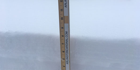
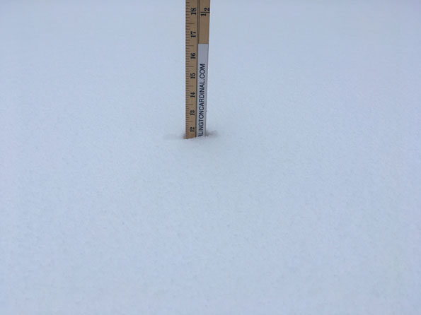
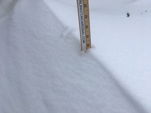
Here are three types of snow measurements in Arlington Heights measure about 9:12 AM Saturday January 19, 2019: New Snowfall, New Snow Cover, and a sample snow drift.
New Snowfall 7.875 inches from about 1:30 p.m. Friday January 18, 2019 to 9:00 a.m. Saturday January 19, 2019 at the end of the main storm’s snowfall
New snow cover depth measures 11.5 inches.
A sample snow drift measurement of 16 inches
The snow is deep, but light and fluffy.
NEW SNOWFALL …

SNOW COVER …

16-INCH DRIFT …

DRIFT …

Snowfall totals as of January 19. https://t.co/u61rlmiMio pic.twitter.com/JsCDCQhBFP
— NWS Chicago (@NWSChicago) January 19, 2019
^^ MOBILE? USE VOICE MIC ^^
facebook …
GET ALERTS on Facebook.com/ArlingtonCardinal
GET ALERTS on Facebook.com/CardinalEmergencies
GET ALERTS on Facebook.com/ArlingtonHeightsCrime
Get updates from The Cardinal ALL NEWS FEEDS on Facebook. Just ‘LIKE’ the ‘Arlington Cardinal Page (become a fan of our page). The updates cover all posts and sub-category posts from The Cardinal — Arlingtoncardinal.com. You can also limit feeds to specific categories. See all of The Cardinal Facebook fan pages at Arlingtoncardinal.com/about/facebook …
Help fund The Cardinal Arlingtoncardinal.com/sponsor
20240105-1435future
Here are the 6 basic steps for properly measuring snow. Your reports are much appreciated. When you do tweet us reports, include your location, whether your report is a measurement or estimate & what time you took it. Thanks! #ilwx #inwx pic.twitter.com/LXwUDe63cj
— NWS Chicago (@NWSChicago) January 19, 2019
