As of 7:55 a.m. Wednesday, active watches or warnings are activated. A second line of thunderstorms is heading toward northeast Illinois, Chicagoland and central Illinois. Radar images show the storms are currently over Rockford, and no Severe Thunderstorm Warning exists for Rockford at 7:55 a.m. The storms are rapidly diminishing as they head east-southeast.

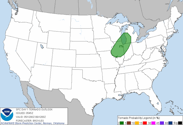
The NOAA/NWS Storm Prediction Center has placed most of northern Illinois, Central Illinois, far southeast Wisconsin, northwest Indiana, and southwest Michigan at a probability for tornados at 2%.
National Weather Service Forecast for Arlington Heights
Today
Showers and thunderstorms likely, mainly after 1pm. Partly sunny, with a high near 89. South southwest wind 5 to 15 mph, with gusts as high as 20 mph. Chance of precipitation is 60%. New rainfall amounts between a tenth and quarter of an inch, except higher amounts possible in thunderstorms.
Tonight
A 20 percent chance of showers and thunderstorms before 10pm. Partly cloudy, with a low around 63. West southwest wind 5 to 10 mph becoming north northwest after midnight.
Thursday
Sunny, with a high near 80. North northwest wind 5 to 10 mph becoming northeast in the afternoon.
Thursday Night
Partly cloudy, with a low around 59. East wind around 5 mph becoming calm in the evening. Winds could gust as high as 10 mph.
Friday
A 40 percent chance of showers. Mostly cloudy, with a high near 75. South wind around 5 mph becoming west in the afternoon.
Become a fan of The Cardinal weather page. Submit your pictures or just stay up-to-date on weather topics — go direct to the Arlington Cardinal Weather photos. For a list of all of The Cardinal Facebook fan pages, go to Arlingtoncardinal.com/about/facebook …
