UPDATE: The morning round of thunderstorms has weakened, but covers a wide area, and will likely persist throughout Chicagoland most of the morning.
The National Weather Service has issued a hazardous weather outlook for the Chicago area and other parts of Illinois that includes a risk of strong to severe thunderstorms and possibly isolated tornadoes.

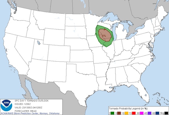
Convective Outlook Map for today indicates an increased risk of a tornado within 25 miles of a point in the shaded area (Red 5% and Green 2%).
Severe thunderstorm risk includes the following counties:
WINNEBAGO-BOONE-MCHENRY-LAKE ILLINOIS-OGLE-LEE-DE KALB-KANE-
DUPAGE-COOK-LA SALLE-KENDALL-GRUNDY-WILL-KANKAKEE-LIVINGSTON-
IROQUOIS-FORD-LAKE INDIANA-PORTER-NEWTON-JASPER-BENTON
Radar shows storms approaching Rockford, Illinois at 8:00 a.m. Tuesday — heading east-southeast.
A second wave of storms is possible late this afternoon.
Become a fan of The Cardinal weather page. Submit your pictures or just stay up-to-date on weather topics — go direct to the Arlington Cardinal Weather photos. For a list of all of The Cardinal Facebook fan pages, go to Arlingtoncardinal.com/about/facebook …
